


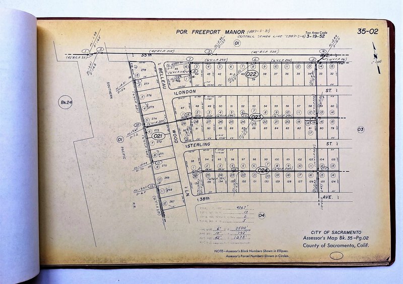

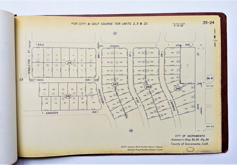


37 SACRAMENTO PLAT MAPS of FREEPORT MANOR, VICTORY ACRES and GOLF COURSE TERRACE
CITY OF SACRAMENTO ASSESSOR'S MAP BOOK. Book 35, for the neighborhoods of Freeport Manor, Victory Acres, Fuller Town, and Golf Course Terrace.
Contains 37 Plat Maps, each 11x17 inches. The plats are 2-hole punched at their left side and bound with a metal bracket into flexible brown covers. There is a label on the front cover that states UNIT COPY 35.
The first two maps are heavily blued but the map and information is still visible with a bit of concentration, a few other maps are starting to turn blue but remain sharp and clear, the rest of the maps are yellow with toning at the margins and are bright, sharp and clear.
Published by the City of Sacramento Assessor's Office. There is a small date at the bottom of a few maps with the date "8-72" and one with the date "8-71", so I would assume these maps are mostly from August 1972.