MAPS OF THE STREETS OF BOSTON Made For The Selectmen…

MAPS OF THE STREETS OF BOSTON Made For The Selectmen in 1819 & 1820 with 140 MAPS - A Facsimile published by Boston City Register in 1894 by Maps Drawn by John Groves Hales < >
  • Another image of MAPS OF THE STREETS OF BOSTON Made For The Selectmen in 1819 & 1820 with 140 MAPS - A Facsimile published by Boston City Register in 1894 by Maps Drawn by John Groves Hales
  • Another image of MAPS OF THE STREETS OF BOSTON Made For The Selectmen in 1819 & 1820 with 140 MAPS - A Facsimile published by Boston City Register in 1894 by Maps Drawn by John Groves Hales
  • Another image of MAPS OF THE STREETS OF BOSTON Made For The Selectmen in 1819 & 1820 with 140 MAPS - A Facsimile published by Boston City Register in 1894 by Maps Drawn by John Groves Hales
  • Another image of MAPS OF THE STREETS OF BOSTON Made For The Selectmen in 1819 & 1820 with 140 MAPS - A Facsimile published by Boston City Register in 1894 by Maps Drawn by John Groves Hales
  • Another image of MAPS OF THE STREETS OF BOSTON Made For The Selectmen in 1819 & 1820 with 140 MAPS - A Facsimile published by Boston City Register in 1894 by Maps Drawn by John Groves Hales
  • Another image of MAPS OF THE STREETS OF BOSTON Made For The Selectmen in 1819 & 1820 with 140 MAPS - A Facsimile published by Boston City Register in 1894 by Maps Drawn by John Groves Hales
  • Another image of MAPS OF THE STREETS OF BOSTON Made For The Selectmen in 1819 & 1820 with 140 MAPS - A Facsimile published by Boston City Register in 1894 by Maps Drawn by John Groves Hales
  • Another image of MAPS OF THE STREETS OF BOSTON Made For The Selectmen in 1819 & 1820 with 140 MAPS - A Facsimile published by Boston City Register in 1894 by Maps Drawn by John Groves Hales
  • Another image of MAPS OF THE STREETS OF BOSTON Made For The Selectmen in 1819 & 1820 with 140 MAPS - A Facsimile published by Boston City Register in 1894 by Maps Drawn by John Groves Hales
  • Another image of MAPS OF THE STREETS OF BOSTON Made For The Selectmen in 1819 & 1820 with 140 MAPS - A Facsimile published by Boston City Register in 1894 by Maps Drawn by John Groves Hales
  • Another image of MAPS OF THE STREETS OF BOSTON Made For The Selectmen in 1819 & 1820 with 140 MAPS - A Facsimile published by Boston City Register in 1894 by Maps Drawn by John Groves Hales
  • Another image of MAPS OF THE STREETS OF BOSTON Made For The Selectmen in 1819 & 1820 with 140 MAPS - A Facsimile published by Boston City Register in 1894 by Maps Drawn by John Groves Hales
  • Another image of MAPS OF THE STREETS OF BOSTON Made For The Selectmen in 1819 & 1820 with 140 MAPS - A Facsimile published by Boston City Register in 1894 by Maps Drawn by John Groves Hales
  • Another image of MAPS OF THE STREETS OF BOSTON Made For The Selectmen in 1819 & 1820 with 140 MAPS - A Facsimile published by Boston City Register in 1894 by Maps Drawn by John Groves Hales
  • Another image of MAPS OF THE STREETS OF BOSTON Made For The Selectmen in 1819 & 1820 with 140 MAPS - A Facsimile published by Boston City Register in 1894 by Maps Drawn by John Groves Hales
  • Another image of MAPS OF THE STREETS OF BOSTON Made For The Selectmen in 1819 & 1820 with 140 MAPS - A Facsimile published by Boston City Register in 1894 by Maps Drawn by John Groves Hales
  • Another image of MAPS OF THE STREETS OF BOSTON Made For The Selectmen in 1819 & 1820 with 140 MAPS - A Facsimile published by Boston City Register in 1894 by Maps Drawn by John Groves Hales
  • Another image of MAPS OF THE STREETS OF BOSTON Made For The Selectmen in 1819 & 1820 with 140 MAPS - A Facsimile published by Boston City Register in 1894 by Maps Drawn by John Groves Hales
  • Another image of MAPS OF THE STREETS OF BOSTON Made For The Selectmen in 1819 & 1820 with 140 MAPS - A Facsimile published by Boston City Register in 1894 by Maps Drawn by John Groves Hales
  • Another image of MAPS OF THE STREETS OF BOSTON Made For The Selectmen in 1819 & 1820 with 140 MAPS - A Facsimile published by Boston City Register in 1894 by Maps Drawn by John Groves Hales
  • Another image of MAPS OF THE STREETS OF BOSTON Made For The Selectmen in 1819 & 1820 with 140 MAPS - A Facsimile published by Boston City Register in 1894 by Maps Drawn by John Groves Hales
  • Another image of MAPS OF THE STREETS OF BOSTON Made For The Selectmen in 1819 & 1820 with 140 MAPS - A Facsimile published by Boston City Register in 1894 by Maps Drawn by John Groves Hales

MAPS OF THE STREETS OF BOSTON Made For The Selectmen in 1819 & 1820 with 140 MAPS - A Facsimile published by Boston City Register in 1894

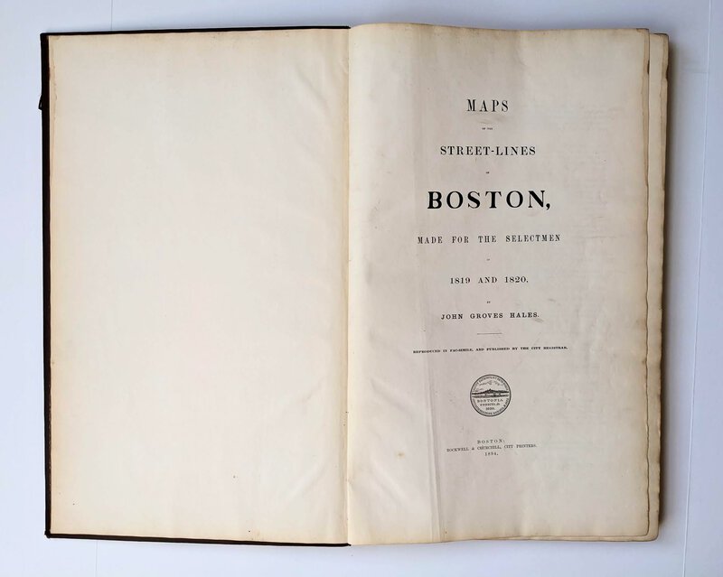
MAPS OF THE STREET-LINES OF BOSTON Made For The Selectmen in 1819 and 1820. DRAWN by John Groves Hales. Published in Facsimile by the Boston City Register, 1894, with new preface and index added.

BOSTON: Boston City Register; Printed by Rockwell and Churchill, City Printers, 1894.

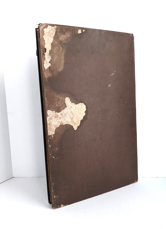
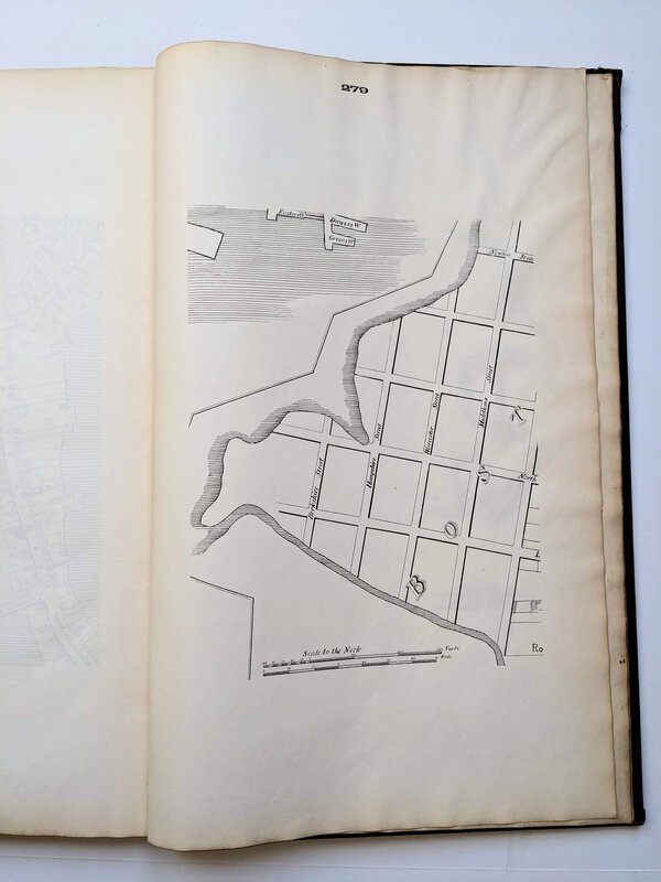
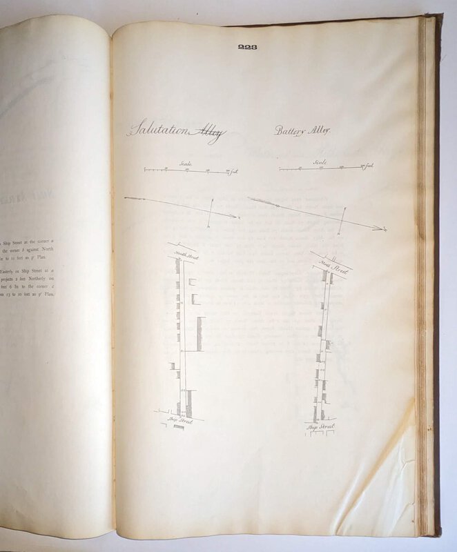
Hardcovers, brown cloth covered boards, front cover titled in gilt, Royal Folio 12.5x20 inches, 285 total pages with approx. 140 maps with descriptions on facing pages (i.e. maps on rectos, descriptions on versos).

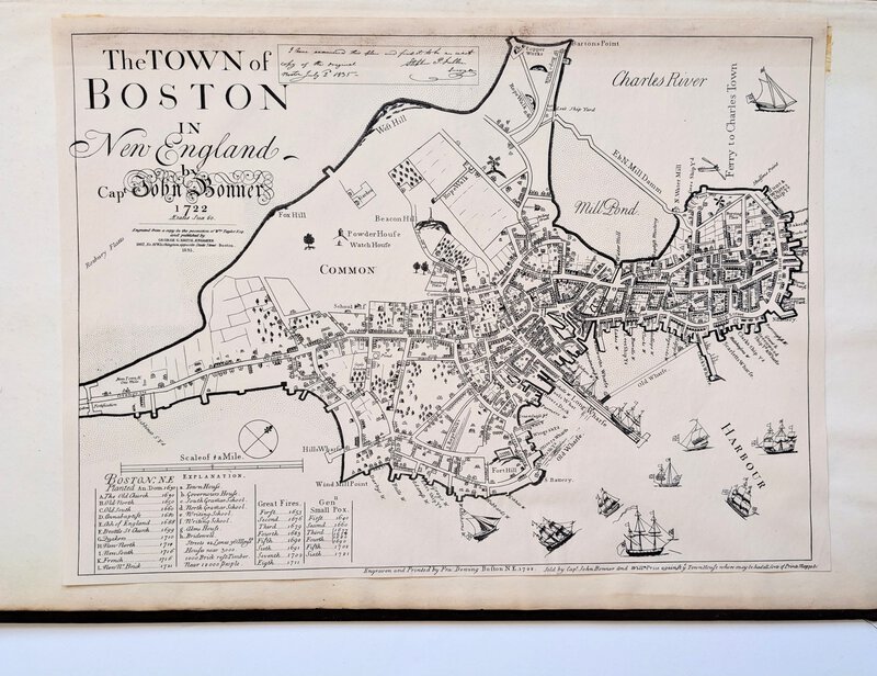
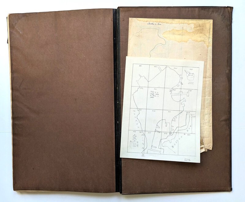
Contains the laid-in folding map "A PLAN OF BOSTON" by Osgood Carleton [1803], and a tipped-in map: "THE TOWN OF BOSTON" undated facsimile originally printed by John Bonner in 1722. (The folding map is often missing from this work.) Also laid in is a hand drawn map, presumably by a previous owner, titled "this is a rough index to these 16 plates" (plates on odd numbered pages 251-281). Handwritten at the bottom of this drawing is "S.F. Tucker / March 1953", presumably the previous owner's name who drew this map.

Condition: The rear cover is damaged, with areas of old water-staining and missing cloth; the front cover and spine are in good shape with some small scrapes and wear at the spine ends and corner tips; aside from the damaged rear board the covers are solid, well bound, and doing their job. INTERNALLY, the upper corner area of the pages is wavy, likely from the water spill to the rear cover, the waviness is most prominent on the latter pages and diminishes as the pages proceed to the front until there is just light waviness to the top margin. Fortunately only the inside rear cover and the blank endpapers show significant shorelining, otherwise just some shorelining to the front and top margin here and there; the margins are toned, as normal in my experience; a few pages are soiled at the margins, there is a pea-size coffee-colored stain to the blank margin of some pages, two pages have a quarter size food stain to the bottom corner; two leaves consisting of pages 221/222 and 223/224 have a bottom corner that has stiff creases and closed tears (looks like the book was badly shut on that corner). Despite its flaws the book is complete, with all its maps, including the folding map, and the maps remain bright and clear.

About JOHN GROVES HALES, the CARTOGRAPHER (from various Internet sources):

******John Groves Hales, b.1785 d.1832, was a cartographer, civil engineer, and surveyor active in Massachusetts in the early part of the 19th century. He is considered by some to be one of the most influential and important New England cartographers of the early 19th century. He was born in England around 1785. Around 1810 Hales emigrated to Portsmouth, New Hampshire where he began surveying New England cities and towns using advanced and highly accurate European style trigonometric techniques in sharp contrast to the rod and chain system more commonly used in the United States at the time. His first major cartographic work in the United States is an 1812 map of Portsmouth, New Hampshire. Around 1813 he relocated to Boston, Massachusetts. In 1819 he was commissioned by the City of Boston to produce city maps, including a vast large-scale map of Boston, the manuscripts for which survive in the Boston city records. He remained an active surveyor and mapmaker until his death in 1832. Hales is buried in the St. Matthews Episcopal Church in South Boston.******

INTERNATIONAL BUYERS PLEASE NOTE: This book is large and heavy and will require substantial additional shipping charges. After placing your order you will be notified of the additional charges and be able to accept or reject them before your payment is processed. Or you can contact us ahead of time to find out the shipping charge to your country. Thanks.

Print this page View cart Price: $900.00