- Category = "Maps, Atlases"
-
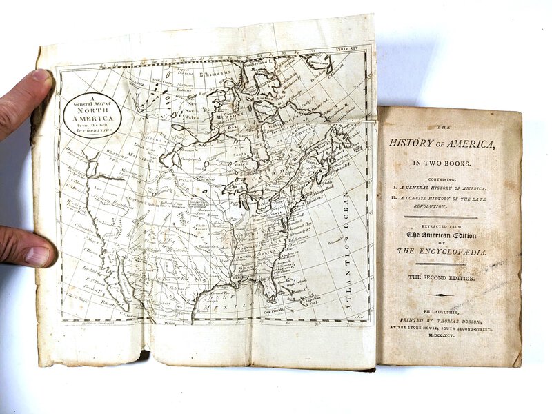
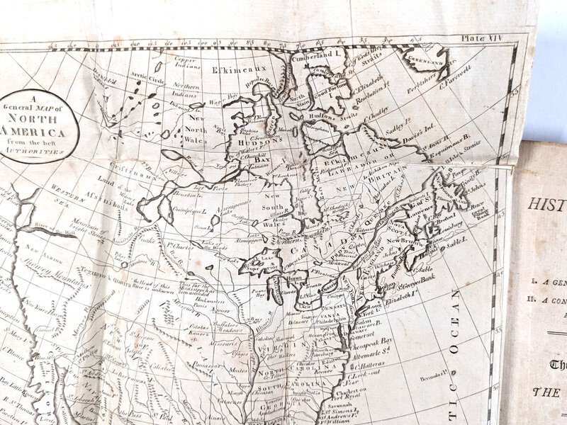
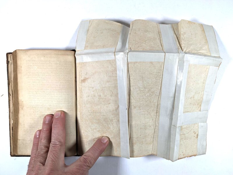
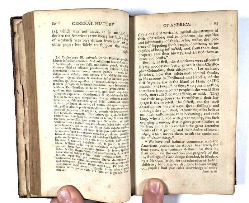
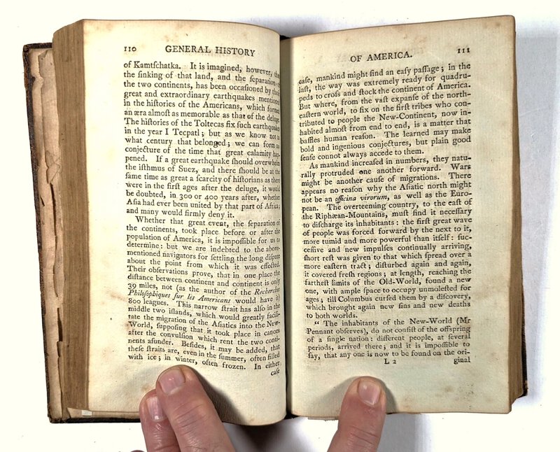
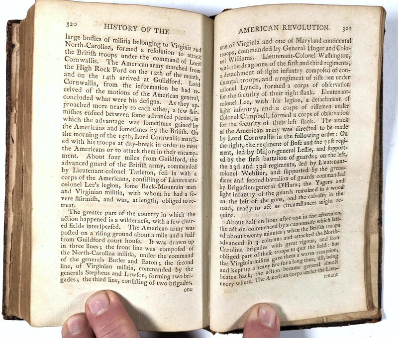
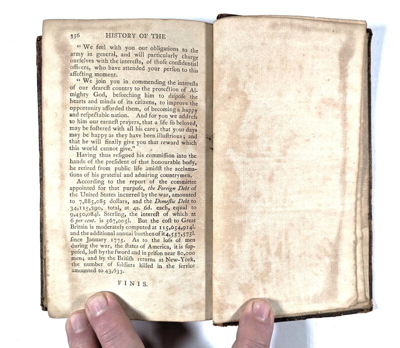
 1795 THE HISTORY OF AMERICA in TWO BOOKS (bound in ONE, as issued) with 2 FOLDING MAPS Philadelphia: Dobson
More details Price: $900.00
1795 THE HISTORY OF AMERICA in TWO BOOKS (bound in ONE, as issued) with 2 FOLDING MAPS Philadelphia: Dobson
More details Price: $900.00 -
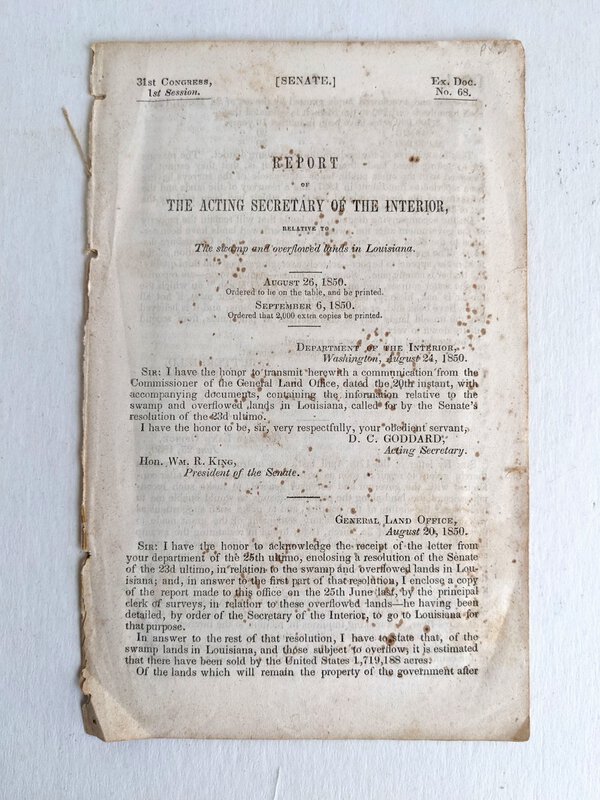
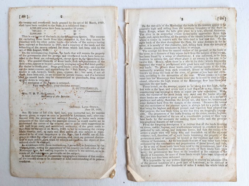
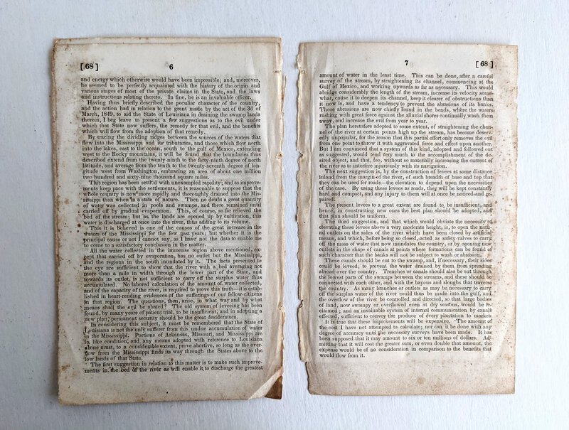
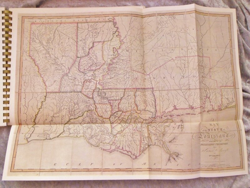
 1850 LOUISIANA SWAMP and OVERFLOWED LANDS SURVEY with FOLD-OPEN MAP
More details Price: $150.00
1850 LOUISIANA SWAMP and OVERFLOWED LANDS SURVEY with FOLD-OPEN MAP
More details Price: $150.00 -
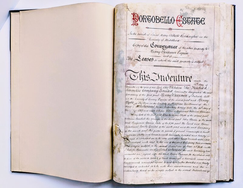
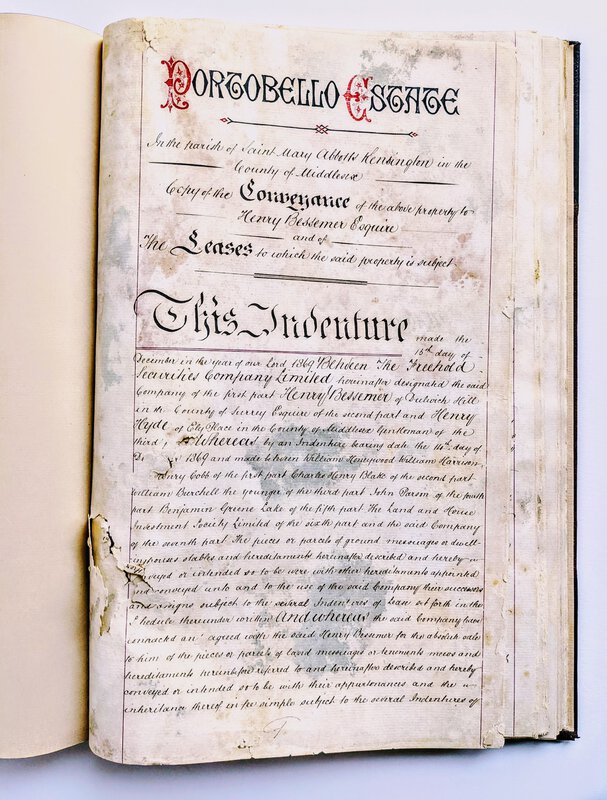
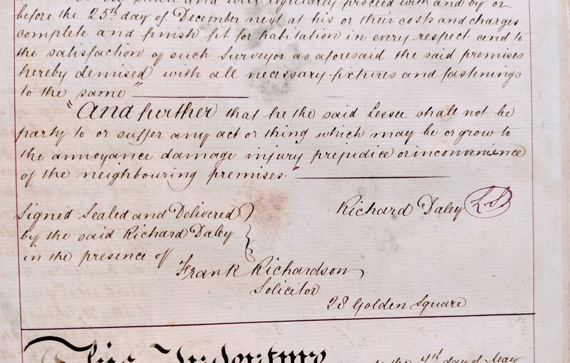
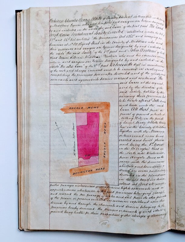
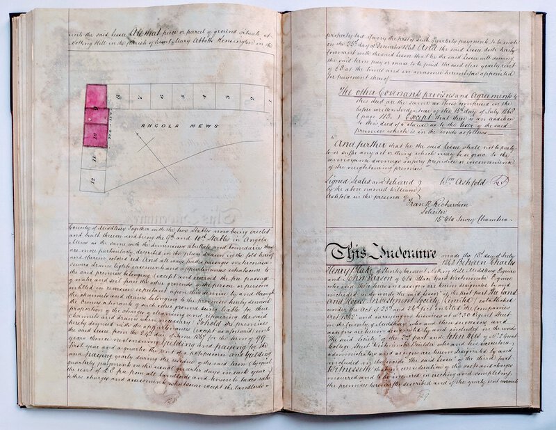
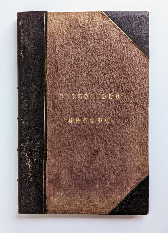
 1868-1869 PORTOBELLO ROAD / PORTOBELLO ESTATE, LONDON - 62 ORIGINAL MANUSCRIPT INDENTURES with PLAT MAPS
More details Price: $3,000.00
1868-1869 PORTOBELLO ROAD / PORTOBELLO ESTATE, LONDON - 62 ORIGINAL MANUSCRIPT INDENTURES with PLAT MAPS
More details Price: $3,000.00 -
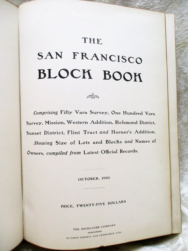
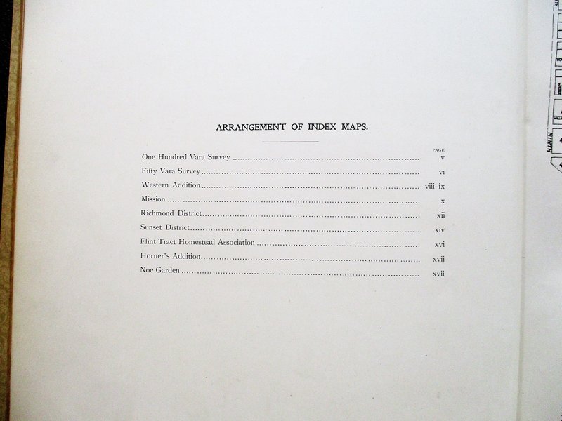
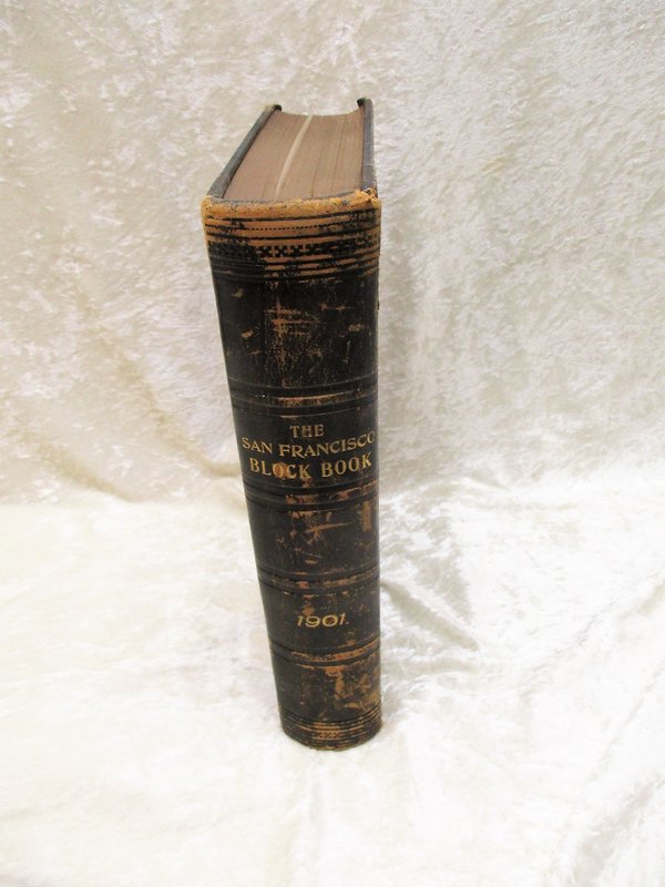
 1901 Original SAN FRANCISCO BLOCK BOOK over 700 MAPS of LOTS, BLOCKS, PARCELS Real Estate of Mission District, Western Addition, Richmond, Sunset District, etc. w/ Names of Owners
More details Price: $1,300.00
1901 Original SAN FRANCISCO BLOCK BOOK over 700 MAPS of LOTS, BLOCKS, PARCELS Real Estate of Mission District, Western Addition, Richmond, Sunset District, etc. w/ Names of Owners
More details Price: $1,300.00 -
 1928 TOBIN MAPS 1978 50TH ANNIVERSARY - 22 MAPS Signed & Inscribed LIMITED 1/500
More details Price: $275.00
1928 TOBIN MAPS 1978 50TH ANNIVERSARY - 22 MAPS Signed & Inscribed LIMITED 1/500
More details Price: $275.00 -
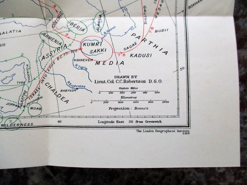
 1930 MAP of ISRAEL'S MIGRATIONS INTO BRITAIN
MAP OF ISRAEL'S MIGRATIONS INTO BRITAIN, by L. G. A. Roberts, Comdr. R.N. London: Covenant Publishing Company, (1930). Fold open map in printed paper covers. The booklet measures 5x7.5 inches. The inner folded map unolds to 11x13.5 inches. There are no other pages, just the paper covers and the inner map. Condition: Covers are toned, the front cover has the name, address and date (1931); the map is bright and clean and unfolds well, it has a 2 inch closed tear along the horizontal fold and some light toning.
More details Price: $25.00 -
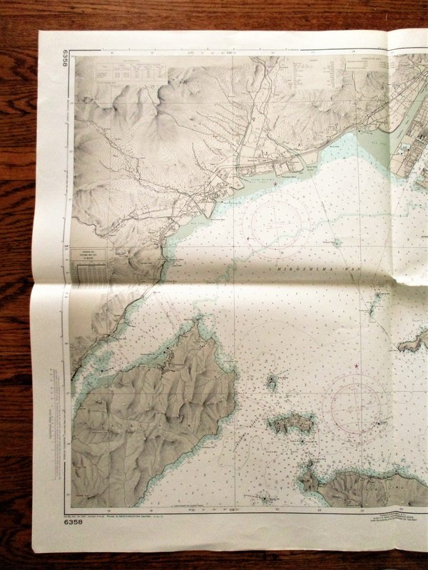
 1972 Soundings Map APPROACHES TO HIROSHIMA Japan Naikai Inland Sea Hiroshima Wan 30x42"
SOUNDINGS MAP in Fathoms. JAPAN NAIKAI (Inland Sea) HIROSHIMA WAN - APPROACHES TO HIROSHIMA. From Japanese surveys to 1947, with additions from Japanese Charts to 1963. 30x42 inches. Published by the U.S. Naval Oceanographic Office under the Authority of the Secretary of the Navy, Washington D.C. Third Edition 1970, with an added ink stamp at the bottom noting changes through 1972. "Reproduction of Chinese Chart No. 341A, edition of Mar. 1969, with minor modifications in accordance with agreement of 1968 between the Republic of China Naval Hydrographic Office and the U.S. Naval Oceanographic Office." GOOD condition. Folded, just lightly used. The map number 97269 is written on the blank backside. Will be shipped rolled in a sturdy mailing tube.
More details Price: $85.00 -
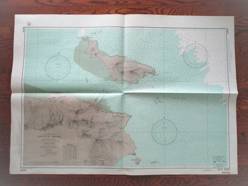
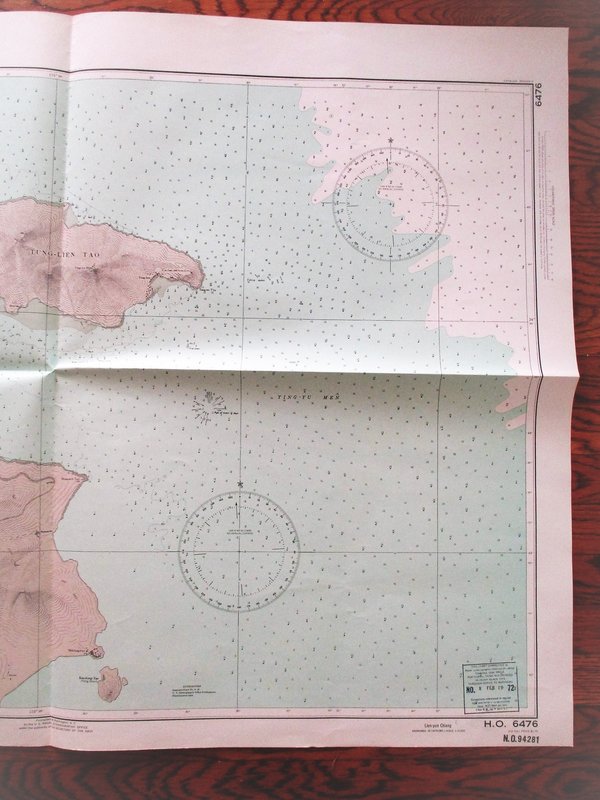
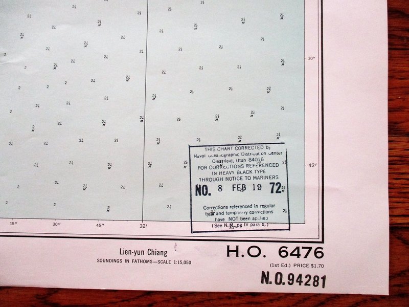
 1972 Soundings Map LIEN-YUN CHIANG China East Coast 30x42"
SOUNDINGS MAP in Fathoms. China East Coast LIEN-YUN CHIANG. From a Japanese survey in 1938. 30x42 inches. Published by the U.S. Naval Oceanographic Office under the Authority of the Secretary of the Navy, Washington D.C. Revised Edition 1968, with an added ink stamp at the bottom noting changes through Feb. 1972. GOOD condition. Folded, just lightly used. The map number 94281 is written on the blank backside. Will be shipped rolled in a sturdy mailing tube.
More details Price: $85.00 -
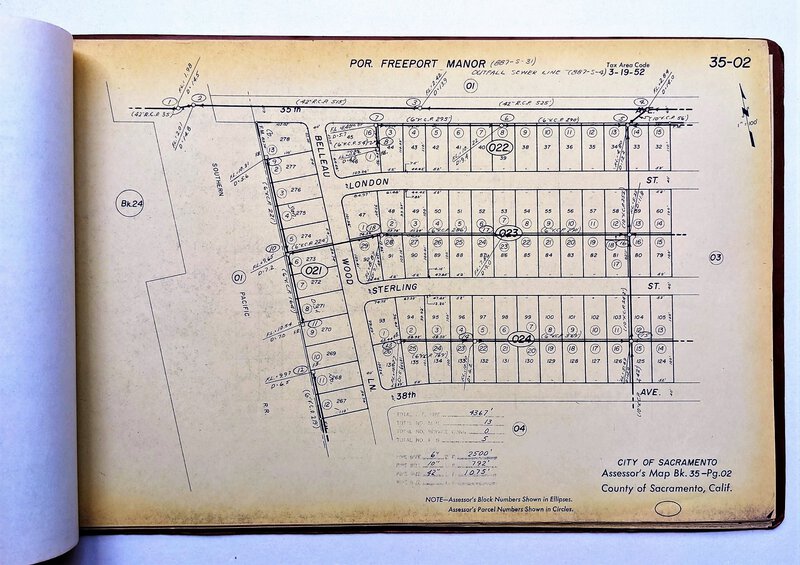
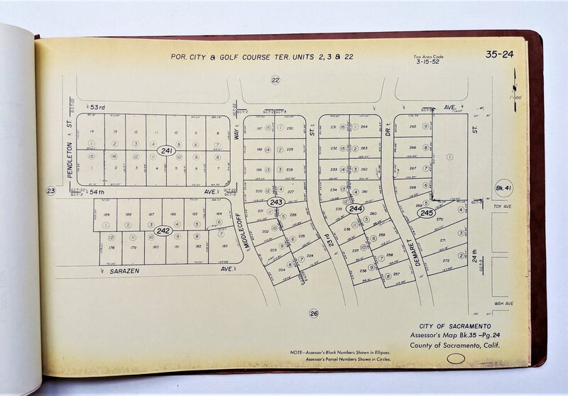
 37 SACRAMENTO PLAT MAPS of FREEPORT MANOR, VICTORY ACRES and GOLF COURSE TERRACE
More details Price: $125.00
37 SACRAMENTO PLAT MAPS of FREEPORT MANOR, VICTORY ACRES and GOLF COURSE TERRACE
More details Price: $125.00 -
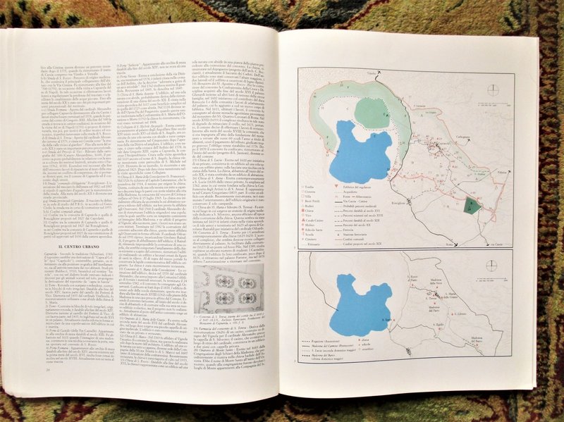
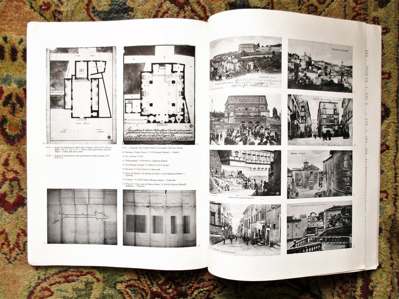
 CAPRAROLA, ITALY Large Format Illustrated HISTORICAL ATLAS Published ROME 1986
More details Price: $45.00
CAPRAROLA, ITALY Large Format Illustrated HISTORICAL ATLAS Published ROME 1986
More details Price: $45.00 -
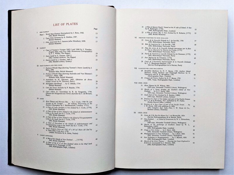
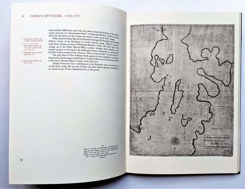
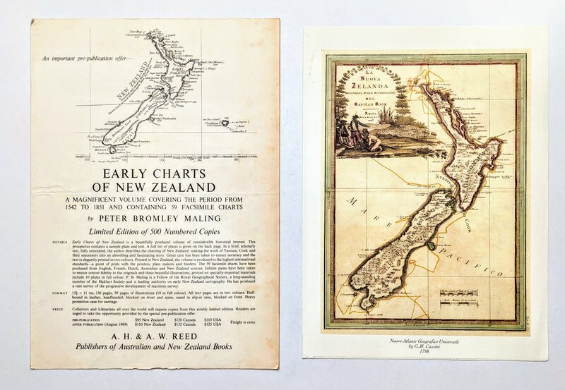
 EARLY CHARTS & MAPS OF NEW ZEALAND 1542-1851 Fine Printing Limited Edition 1/500 w/ 59 PLATES
More details Price: $900.00
EARLY CHARTS & MAPS OF NEW ZEALAND 1542-1851 Fine Printing Limited Edition 1/500 w/ 59 PLATES
More details Price: $900.00 -
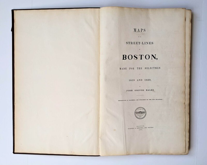
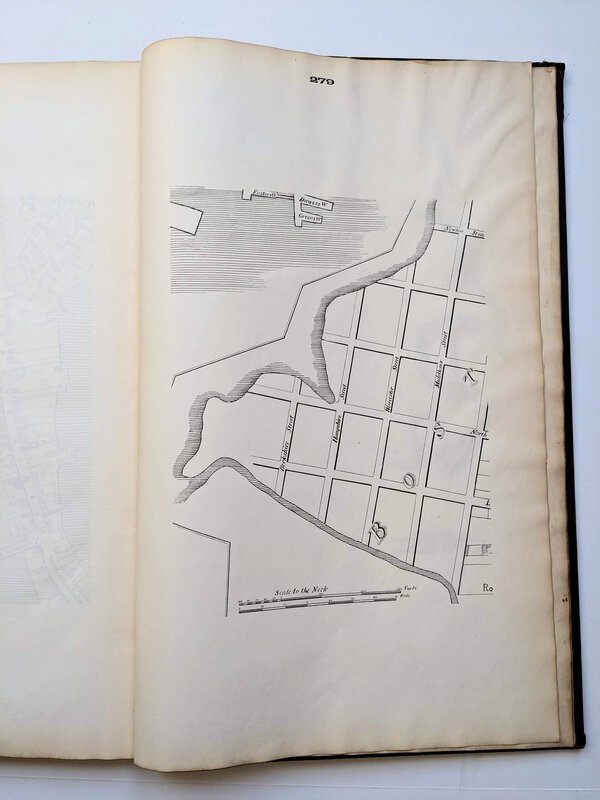
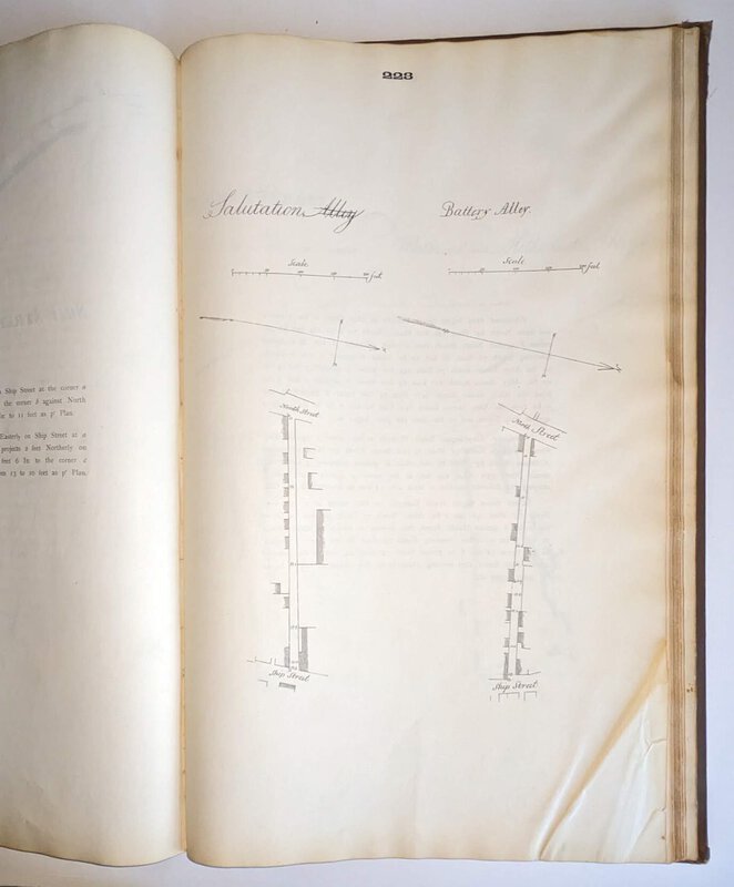
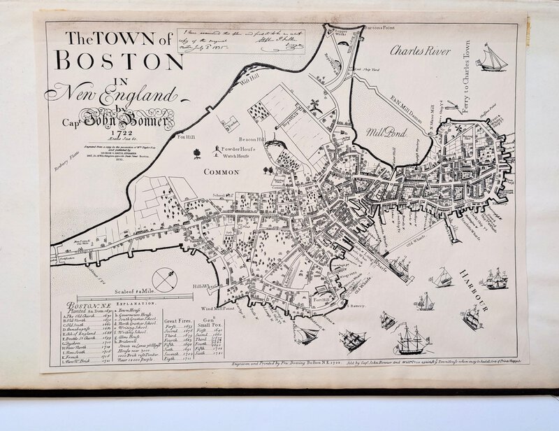
 MAPS OF THE STREETS OF BOSTON Made For The Selectmen in 1819 & 1820 with 140 MAPS - A Facsimile published by Boston City Register in 1894
More details Price: $900.00
MAPS OF THE STREETS OF BOSTON Made For The Selectmen in 1819 & 1820 with 140 MAPS - A Facsimile published by Boston City Register in 1894
More details Price: $900.00 -
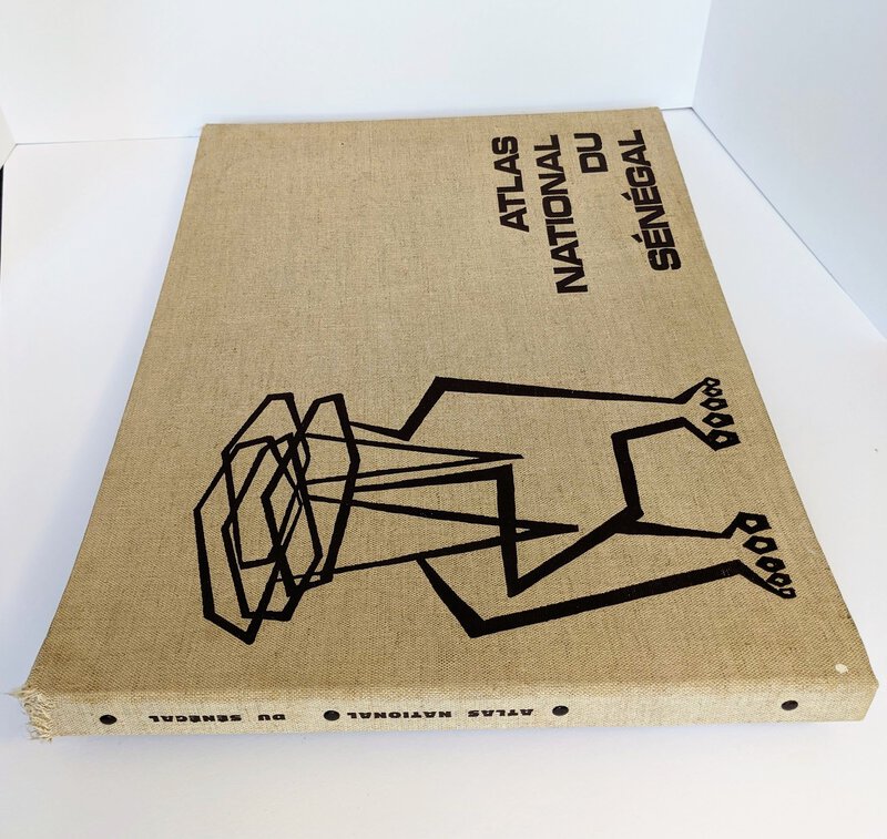
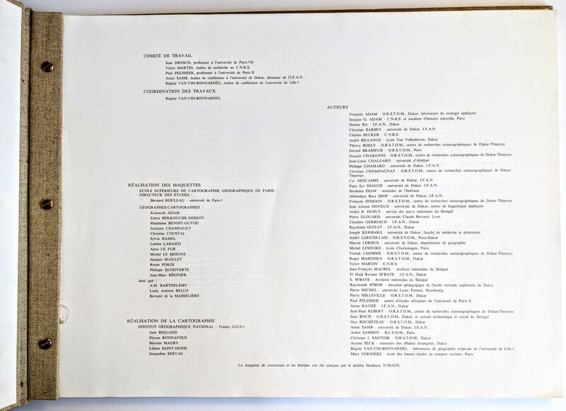
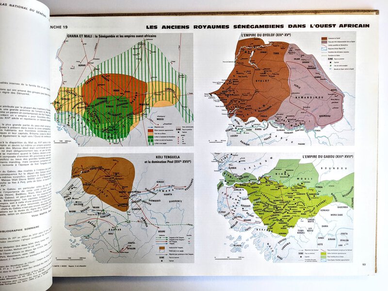
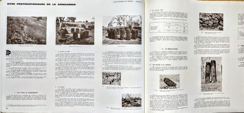
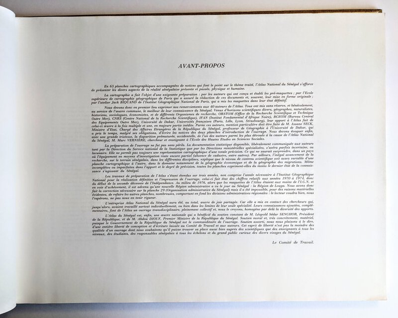
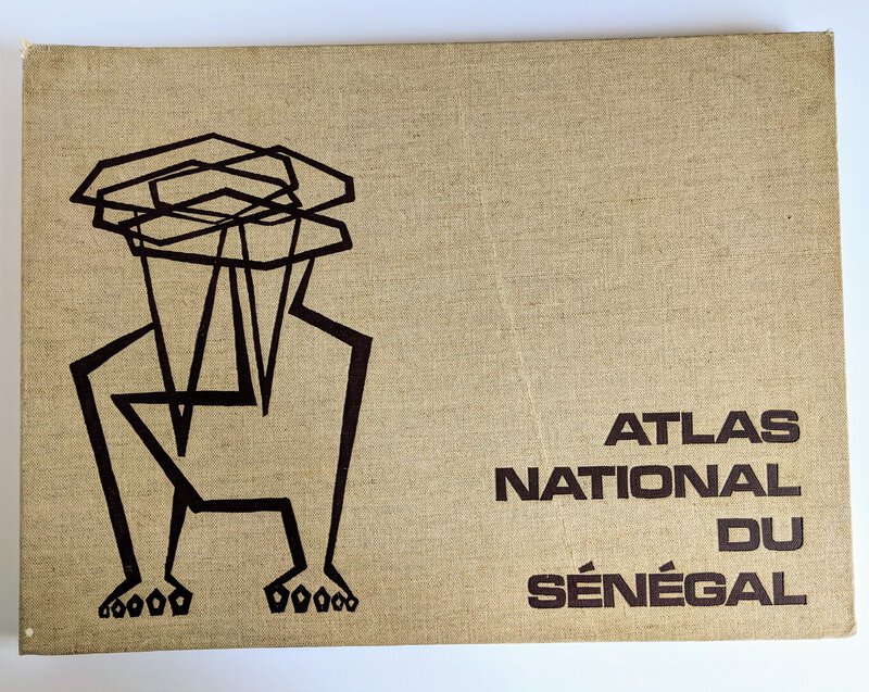
 NATIONAL ATLAS OF SENEGAL with 65 LARGE COLOR MAPS 1977
More details Price: $200.00
NATIONAL ATLAS OF SENEGAL with 65 LARGE COLOR MAPS 1977
More details Price: $200.00 -
 PRINCETON NJ MAPS -TWO LARGE FOLIO VOLUMES - SANBORN INSURANCE MAPS OF PRINCETON 1927 and FRANKLIN SURVEY REAL ESTATE ATLAS OF PRINCETON 1930
More details Price: $2,000.00
PRINCETON NJ MAPS -TWO LARGE FOLIO VOLUMES - SANBORN INSURANCE MAPS OF PRINCETON 1927 and FRANKLIN SURVEY REAL ESTATE ATLAS OF PRINCETON 1930
More details Price: $2,000.00 -
 Vintage ICE ATLAS OF THE NORTHERN HEMISPHERE Arctic Sea and River Ice Conditions 1946 Folio CLIMATE CHANGE Primary Source
More details Price: $2,250.00
Vintage ICE ATLAS OF THE NORTHERN HEMISPHERE Arctic Sea and River Ice Conditions 1946 Folio CLIMATE CHANGE Primary Source
More details Price: $2,250.00